

Rain drenches Southern California as strongest in series of storms moves in

Weather Forecast for Monday, Jan. 22
The latest forecast and air quality conditions for the greater Los Angeles area, including beaches, valleys and desert regions.
LOS ANGELES - More rain doused Southern California Monday as the strongest in a series of storms moved across the region, leading to flooding on some freeways that left many commuters stuck in a worse-than-usual morning drive.
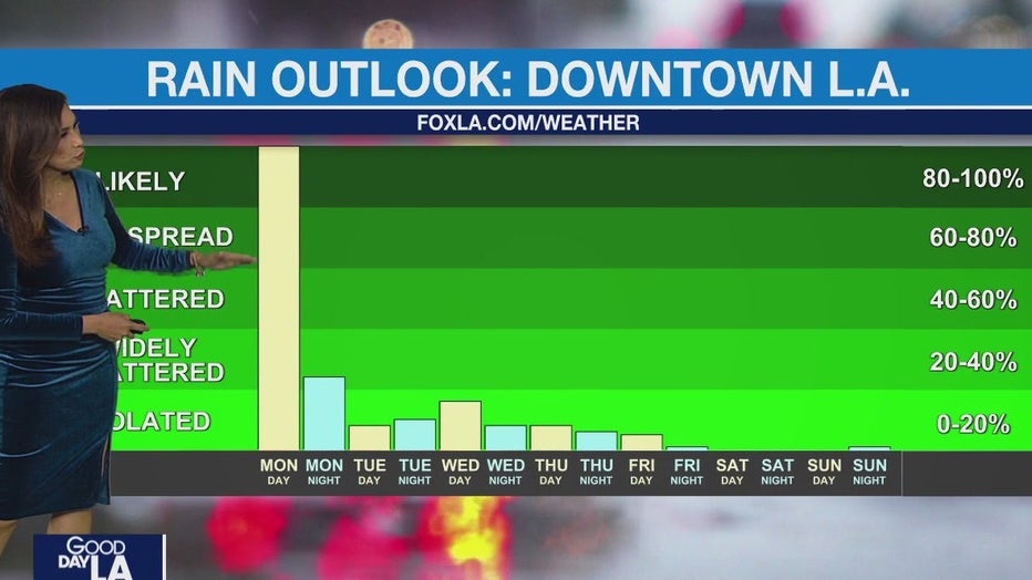
The bulk of the rain came Monday and is expected to move east by midnight. Tuesday there is a low chance of light showers in the morning, but the rest of the day is expected to be dry and warm. There is a slight chance of light rain for Wednesday and Thursday and the weekend is expected to be dry and warm again.
Over the 24 hour period that ended at 4 p.m. Monday, Culver City received an inch of rain, according to the NWS, while downtown received 1.2 inches, and Redondo Beach was hit with 1.4 inches. At UCLA, 1.2 inches fell. Roughly 1.5 inches was recorded in San Gabriel, but most valley areas had received less than an inch.
With Monday being the peak in a series of storms, the National Weather Service issued weather advisories.
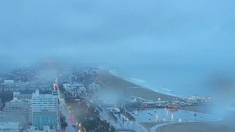
FOX 11's camera shows a soggy Santa Monica on the morning of Monday, Jan. 22, 2024.
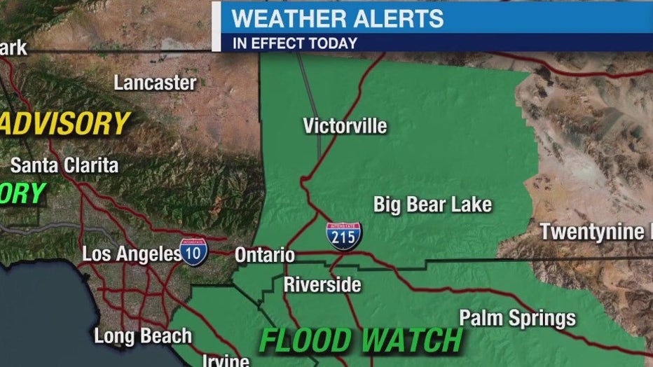
Weather Alerts
Evacuation Warning

Topanga Canyon evacuation warning
The area is on alert for possible mudslides due to heavy downpours.
An evacuation warning was in effect for the Topanga Canyon area. Residents in the area experienced a wildfire, known as the Owen Fire, last summer. It left a burn scar which makes the area vulnerable to mud and debris flows.

Flood Watch
A Flood Watch is in effect Monday from 9 a.m. to 9 p.m. in Orange, San Bernardino, and Riverside counties.
The NWS warns excessive rainfall could lead to flooding in some areas.
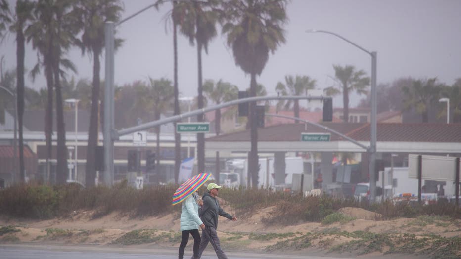
(Getty Images)
This impacts areas such as Costa Mesa, Mission Viejo, Lucerne Valley, Running Springs, Victorville, Corona, Palm Springs, Big Bear City, Moreno Valley, Lake Arrowhead, Big Bear Lake, Crestline, Laguna Beach, Wrightwood, and Ontario.
These areas could also see thunderstorms.
Rain chances will linger in the San Bernardino Mountain communities through Tuesday.
RELATED: California weather forecast: Timeline for rain across SoCal
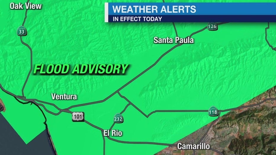
Flood Advisory
A Flood Advisory expired in west and central Ventura County at 7 a.m. Monday.
Wind Advisory
The NWS issued a wind advisory beginning at 11:10 p.m. Sunday that remained in effect through 2 p.m. Monday.
South to southwest winds of 20 to 30 mph with gusts between 40 and 55 mph are expected, with the strongest winds to hit the mountains and Antelope Valley foothills. This also applies to the Santa Clarita Valley, the western and eastern San Gabriel Mountains, and will impact communities such as Lake Castaic, Valencia, Gorman, the Tejon Pass, Acton and Pyramid Lake.
Surf Advisory
A high surf advisory is in effect from 1 a.m. Tuesday until noon Wednesday for Santa Barbara and Ventura County beaches. Waves as high as four to seven feet are expected in Ventura County and waves seven to 11 feet are expected in Santa Barbara County.
Winter Advisory
A winter weather advisory is in effect till 10 p.m. Monday for the San Bernardino and Riverside county mountains. Snow is expected for areas above 6,500 feet elevation with additional snowfall in excess of 6 inches over mountain passes.