

Los Angeles weather: Second storm brings another round of rain, mountain snow to SoCal
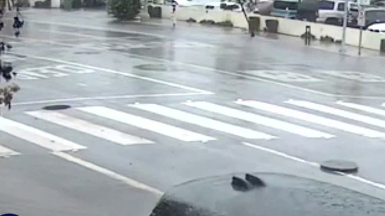
Manhole covers in Santa Monica blowing off from water pressure
Residents in Santa Monica said manhole covers, which could weigh up to 300 pounds, were blowing into the air during Monday's storm.
LOS ANGELES - Keep your umbrella handy for the rest of the week. The second in a trio of storms brought another round of rain Tuesday night to Southern California.
What we know:
The second wave hit late Tuesday night and is expected to last through Wednesday morning in parts of Los Angeles.
The strongest storm in the series hammered the region Monday, bringing flash flooding, mountain snow, and mud and debris flows. At one point, federal officials ordered a ground stop at Los Angeles International Airport due to thunderstorms.
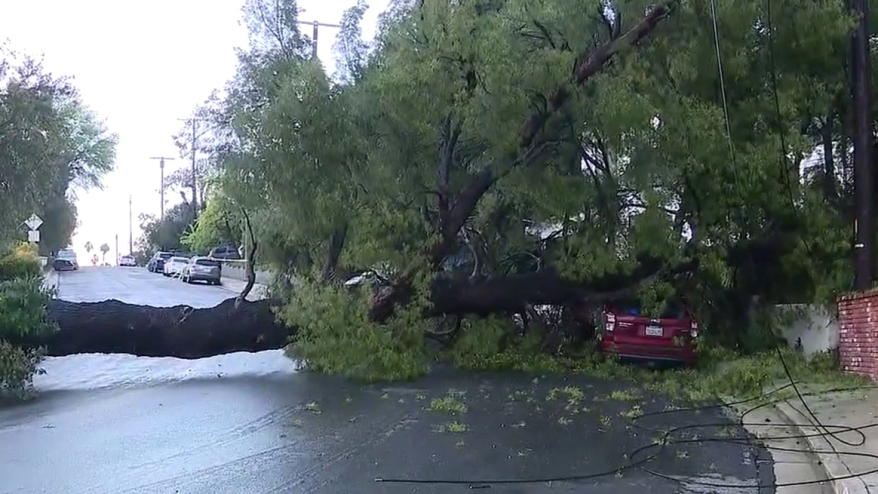
From Melrose to Woodland Hills, people were busy Tuesday morning cleaning up Monday's mess. Several shops along Melrose were damaged due to flooding. And several downed trees damaged cars and caused power to go out in some Woodland Hills neighborhoods.
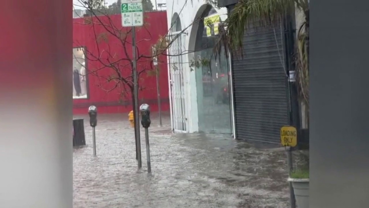
Melrose businesses still cleaning up flood damage
Frustrated store owners continue to cleanup after Monday’s rain damaged several shops in Melrose.
Topanga Canyon Boulevard will remain closed through Wednesday morning in both directions from Pacific Coast Highway to Grand View Drive, according to Caltrans. The area experienced multiple mud and debris slides on Monday.
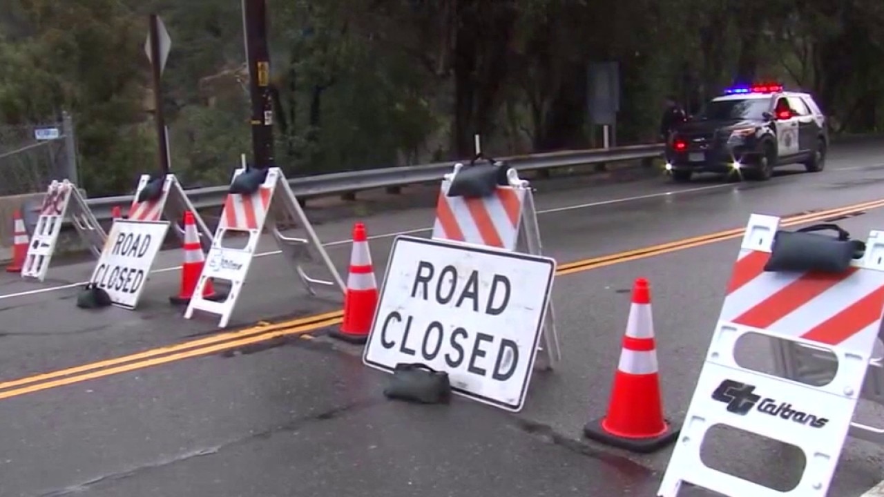
Topanga Canyon road closures impacting businesses
Business owners along Topanga Canyon say between the recent rains and floods and wildfires, the constant shut down of road closures in the area is impacting their sales.
Timeline:
Wet conditions are expected throughout the week.
It was mostly cloudy skies through Tuesday afternoon. However, strong winds, high surf and mountain snow remain a threat, along with the potential for mud and debris flows in recent burn scar areas. The second wave of the storm will hit the LA area by Tuesday night, with heavy rain expected at midnight or 1 a.m.
Storm-soaked Southern California braces for more rain
The second in a series of storms is set to hit Southern California by Tuesday night.
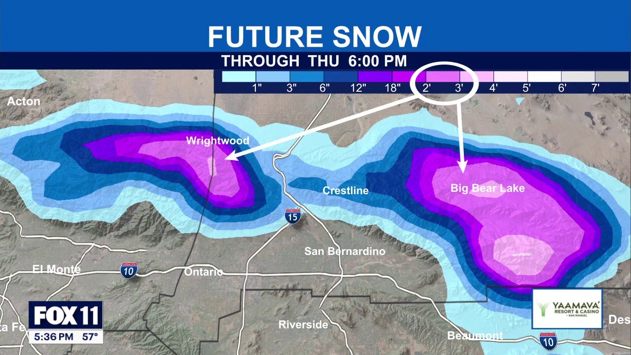
"Once everything is said and done, around the 4,500-foot level, we’re talking about 6 inches to possibly a foot of snow," FOX 11 meteorologist Soumada Khan said. "Snow levels dipping to around 3,500 feet are low enough to impact the passes and canyons, where 1 to 4 inches is possible."
Weather Forecast: Tuesday, Feb. 17
The latest forecast and air quality conditions for the greater Los Angeles area, including beaches, valleys and desert regions.
Tuesday
Scattered showers are expected Tuesday before the second storm arrives in the evening.
"There’s going to be a lot more rain breaks, so enjoy it while we can," Khan said. "We’re awaiting storm system number two set to arrive later tonight into the overnight hours, potentially impacting your Wednesday morning drive, and then a nice little break once again."
Tuesday night and Wednesday
Forecast models show heavier rain moving in late Tuesday night into Wednesday morning, followed by a break Wednesday afternoon and evening.
Travel along the Grapevine could also be impacted Wednesday as the colder storm moves in.
Thursday
"Thursday morning, around 9, 10, 11 o’clock, yet another third system moves into the region," Khan said.
When will it clear up?
What's next:
Conditions are expected to clear just in time for the weekend. However, another storm could hit by early next week.
The Source: This report is based on forecasts and analysis from FOX 11's weather team, along with data from National Weather Service forecast models and federal aviation officials. Information was compiled from official weather briefings and airport advisories.