

Trio of powerful storms set to drench Southern California starting Sunday: Timeline
Triple-storm system enters SoCal forecast
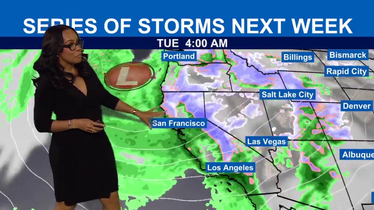
A trio of storms are expected to move across the Southland as early as Sunday, with snow likely at higher elevations, according to the National Weather Service.
LOS ANGELES - Southern California is bracing for a dramatic weather shift as a series of three powerful storm systems are forecast to end a warm dry spell, bringing heavy rain and hazardous conditions through late next week.
Following a mild Saturday, the region will enter a prolonged wet period that could see mountain peaks receive up to 6 inches of total rain, according to the National Weather Service.
What we know:
A warming trend fueled by light offshore winds will persist through Saturday, with coastal areas and valleys seeing highs in the upper 60s to low 70s.
But the NWS has identified Sunday as a "transition day" before the first and strongest system arrives from the northwest.
This initial wave is expected to deliver the heaviest rainfall on Monday.
Forecasts call for 1 to 3 inches of rain in coastal and valley areas and 2 to 5 inches in the mountains.
PREVIOUS COVERAGE: Triple-storm system headed to Southern California: Timeline
"Monday has the highest chance for debris flows in the burn areas," according to the NWS.
Additionally, thunderstorms combined with strong winds and rough seas are expected to create dangerous marine conditions early in the week.
What we don't know:
While the timing for the first storm is mostly certain, meteorologists noted that "it’s always difficult to time these features 4 or more days out," especially when it comes to the exact duration of the second and third storm systems.
While debris flows are a major concern, the exact locations of the most intense rain rates within specific burn scars remain difficult to pinpoint until the storm is closer to landfall.
Timeline:
Friday – Saturday: Mild, warm weather with peak temperatures and overcast skies.
Sunday: Transition day; the first storm system reaches the Central Coast by Sunday night.
Monday: Widespread heavy rain; the "wettest" period of the week with peak debris flow risk.
Tuesday – Wednesday: The second storm arrives; temperatures drop and snow levels fall significantly.
Thursday: A third system may impact the region, though moisture levels remain unconfirmed.
What they're saying:
"Sunday will be a transition day as a potent storm system approaches from the northwest," the agency stated.
Forecasters also warned of the rapidly changing mountain environment, noting that snow levels could fall as low as 2,500 to 3,000 feet at times, creating "possible travel hazards on mountain roads."
What's next:
Snow levels will undergo a dramatic change.
While they will start near 6,500 feet on Monday, they are forecast to tumble to near 5,000 feet Tuesday and potentially 3,000 feet by Wednesday.
This shift could bring significant snow to lower mountain passes that rarely see accumulation, potentially impacting major travel corridors.
What you can do:
- Clear drainage: Ensure gutters and storm drains are clear of debris to prevent localized flooding.
- Monitor burn scars: Residents near recent burn areas should stay alert for weather updates and be prepared to evacuate if debris flow warnings are issued.
- Avoid the surf: Stay away from rock jetties and the water, as large breaking waves and dangerous rip currents are expected.
- Prep for snow: If traveling through mountain passes Tuesday or Wednesday, carry tire chains and an emergency kit.
The Source: This report is based on information from the National Weather Service.