

Dangerous heat wave and monsoonal storms to grip Southern California
Weather Forecast for Sunday, July 12
The latest forecast and air quality conditions for the greater Los Angeles area, including beaches, valleys and desert regions.
LOS ANGELES - A brief relief from peak temperatures during the weekend will quickly give way to an oppressive combination of high humidity, monsoonal storm risks, and a massive mid-week heatwave across Southern California, according to the National Weather Service.
The agency is warning that dangerous, potentially illness-inducing heat will blanket most of the region next week, including typically cooler coastal zones.
What we know:
Temperatures fell slightly on Friday from Thursday's peak, causing heat advisories for downtown Los Angeles, inland coastal areas, and the Santa Clarita, San Fernando, and San Gabriel valleys to temporarily expire, according to the latest forecasts. However, conditions remain sticky as monsoonal moisture moves into the region.
A 5-10% chance of showers and thunderstorms begins Saturday night, bumping up to a 10-20% chance on Sunday and lasting into much of next week, the NWS said.
The humidity will significantly amplify physical discomfort as temperatures begin spiking upward again.
Timeline:
- Sunday (10 a.m.) to Tuesday (10 a.m.): Heat advisories are reinstated for inland coastal areas and major valleys. A separate advisory remains active for the San Gabriel Mountains and the 5 and 14 Freeway corridors, where near-triple-digit temperatures are expected.
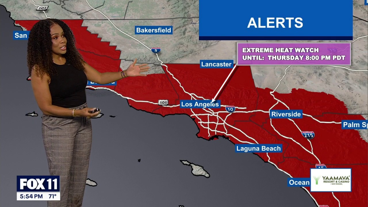
- Tuesday Morning to Thursday Evening: All previous advisories expand into a sweeping extreme heat watch covering almost the entire Southland, including LA County beaches and the Malibu coast.
What they're saying:
NWS forecasters are urging residents to take the upcoming temperature spike seriously, emphasizing that the weather will pose health hazards to vulnerable groups.
"There is a high risk for dangerous heat illness for anyone, especially for the very young, the very old, those without air conditioning, and those active outdoors," NWS forecasters said.
Forecasters also noted that next week, the typically hottest valley areas could see temperatures of up to 112 degrees, while coastal areas could potentially reach a scorching 95 degrees.
What's next:
As the extreme heat watch takes effect on Tuesday, the region will likely face its most intense stretch of weather, according to the NWS.
At the same time, a swell will impact local beaches through next week, elevating the risk of dangerous rip currents and introducing the threat of minor coastal flooding during high tide periods.
The Source: This report is based on information from the National Weather Service. City News Service contributed.