

Southern California storm timeline: Back-to-back systems to bring rain, snow
Weather Forecast for Sunday, April 12
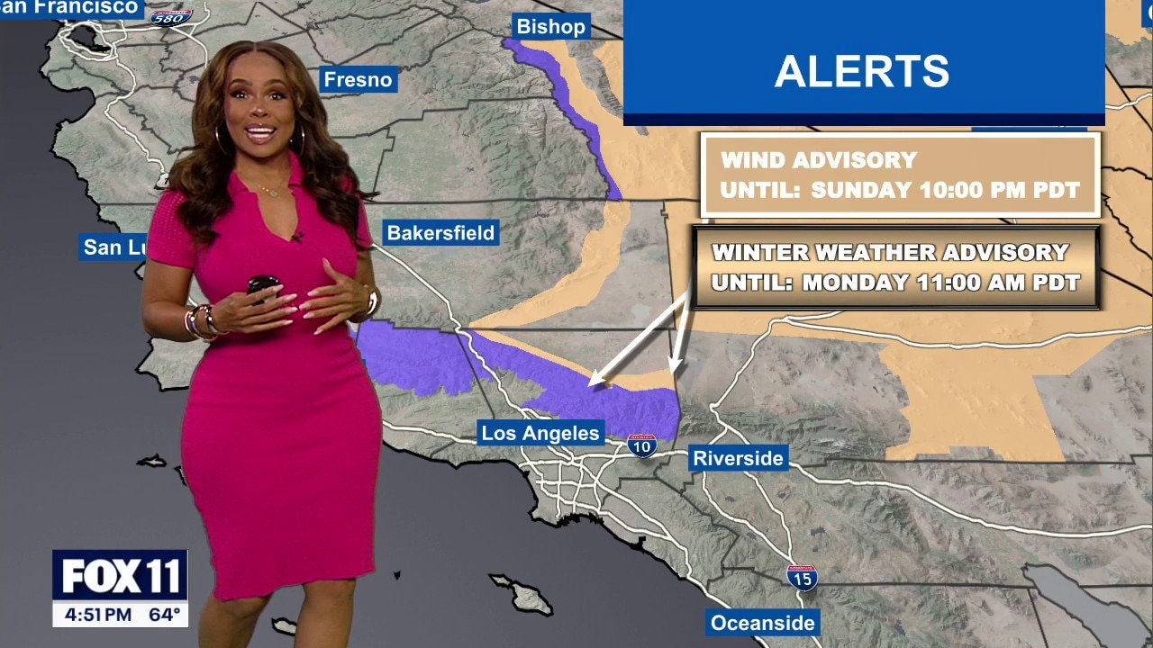
The latest forecast and air quality conditions for the greater Los Angeles area, including beaches, valleys and desert regions.
LOS ANGELES - Following a period of above-average heat, Southern California is bracing for a double-header of spring storms.
The National Weather Service predicts a significant shift in weather patterns, bringing rain, wind, and mountain snow to the region.
What we know:
The NWS has confirmed that two distinct storm systems will move into the region.
"The first system for late Friday into Saturday will have minimal impact as the upper low remains mostly over Northern California," according to the weather agency.
Rainfall for this wave will range from a trace to a quarter inch.

The second system, arriving late Saturday into Sunday, will be much stronger.
Forecasters said this system could bring widespread rain with a greater than 80% chance of precipitation, along with "the possibility of thunderstorms, gusty winds and brief heavy downpours."
Wind speeds are expected to peak between 15-30 mph with gusts reaching 50 mph in interior mountains and foothills, the NWS said.
What we don't know:
While confidence is high regarding the arrival of rain, there is lower confidence in the exact rainfall amounts and peak rain rates.
Forecasters are also monitoring the 15-30% chance of thunderstorms, which could lead to highly variable totals across the region.
It's unclear if rain rates will reach debris flow thresholds for recent burn scar areas.

Timeline:
- Friday – Saturday Morning: The first wave of light, off-and-on showers begins with minimal impact.
- Late Saturday – Sunday Morning: The stronger second storm moves in, bringing the heaviest rain and potential for lightning and hail.
- Sunday (Early to Mid-Morning): The main front is expected to pass through Los Angeles County.
- Sunday Night – Monday Morning: Showers may linger and snow levels will lower to 4,500–6,000 feet before the system clears.
- Midweek: A warming trend is expected to begin by Wednesday.
What you can do:
- Adjust weekend plans: Anticipate wet conditions and potential travel delays through Sunday.
- Secure outdoor items: High winds could displace patio furniture or decorations, especially in mountain and valley areas.
- Practice road safety: "Turn around, don't drown" if you encounter flooded roadways, and allow extra travel time.
- Stay informed: Monitor local NWS updates for potential debris flow alerts or wind advisories.
What's next:
Temperatures will remain below normal through early next week.
While drier conditions return by Tuesday, the NWS is watching for a "chance for more rain at the end of next week."
The Source: This report is based on information from the National Weather Service.