

Major spring storm to bring heavy rain, mountain snow to Southern California: Timeline
Weather Forecast for Wednesday, April 8
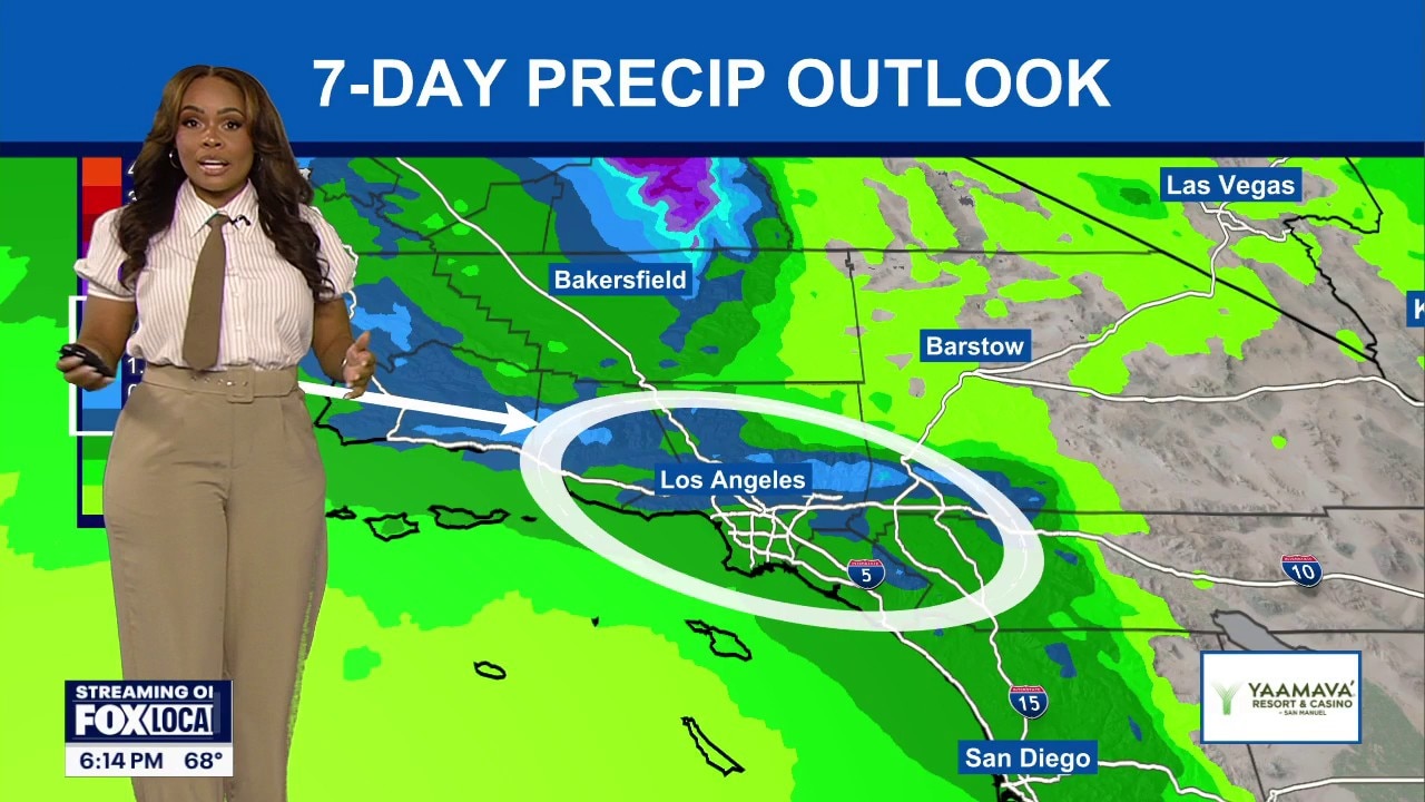
The latest forecast and air quality conditions for the greater Los Angeles area, including beaches, valleys and desert regions.
LOS ANGELES - Southern California will see a dramatic swing in temperatures this week, with a brief Wednesday warm-up followed by a cooling trend and increasing chances of rain beginning Friday, according to the National Weather Service.
The shift follows an unusually hot stretch of record-breaking temperatures and elevated fire danger across the region.
What we know:
While Wednesday will see a brief return to warmer conditions due to shifting winds, a more significant storm system is tracking toward the coast for the end of the week.
Current forecasts indicate an 80% likelihood of rain across the region, the NWS said.
Rainfall totals are currently estimated at around a half-inch for most areas, though thunderstorms could push those totals to an inch or more. In the mountains, snow levels are forecast to drop to around 6,500 feet late Saturday and near 6,000 feet by Sunday. according to the latest forecast.
The NWS predicts gusty southwest to west winds of 35 to 45 mph are expected in mountain and desert areas Thursday and Friday.
What we don't know:
The exact timing and intensity of the rain remain uncertain.
Forecasters are also still monitoring the potential for isolated flooding if predicted thunderstorms develop over areas where the soil is already highly saturated.
Timeline:
- Wednesday: A brief warm-up; expected to be the warmest day of the week with inland temperatures 10 degrees above average.
- Thursday: Cooling resumes; cloud cover and winds increase as the storm system approaches.
- Friday Night – Saturday: Peak storm activity; widespread rain, potential thunderstorms, and gusty winds.
- Sunday: Lingering showers possible with snow levels dropping to 6,000 feet; highs remain in the 60s.
- Early Next Week: Drier and warmer conditions are expected to return.
What's next:
Residents are advised to prepare for a wet weekend by clearing gutters and securing outdoor items.
Drivers should anticipate slick roads and potential travel delays, particularly on mountain passes where snow or heavy downpours could impact visibility.
By Sunday, high temperatures could be as much as 10 to 15 degrees below average for mountains and inland valleys.
The Source: This report is based on information from the National Weather Service.