

Updated Southern California rainfall totals for Feb. 16
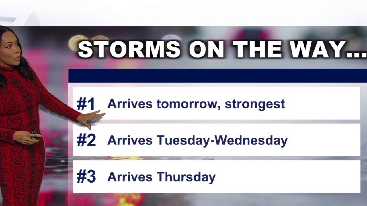
1st of 3 powerful storms slams SoCal
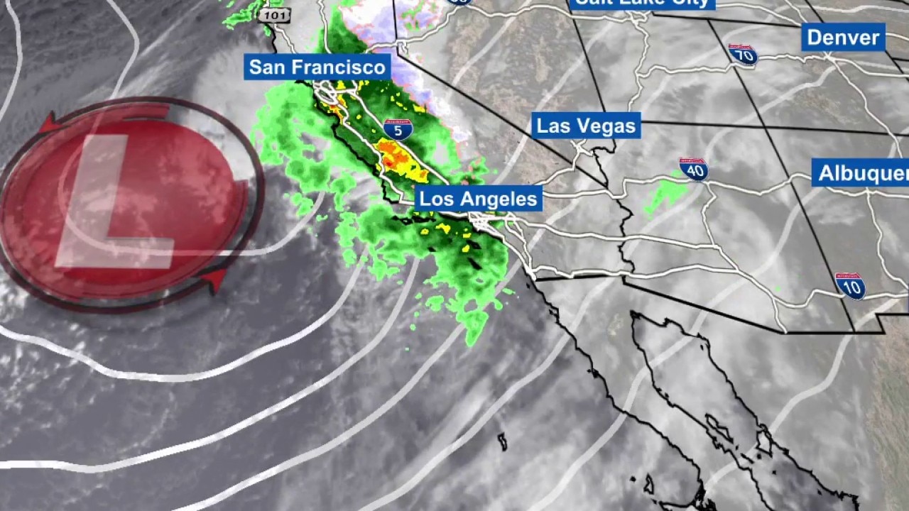
Monday's storm is expected to be the heaviest and most dangerous.
LOS ANGELES - A powerful storm system made itss way through Southern California on Presidents’ Day, bringing the threat of flash flooding, gusty winds, and hazardous travel conditions.
It was the first of three storms set to drench the region in the coming days. Monday's storm was expected to be the heaviest and produce the greatest overall rainfall totals, with forecasts calling for about 1 to 3 inches in coastal and valley areas and 2 to 5 inches in the mountains by late Monday.
RELATED: LIVE UPDATES: Flash flood warning issued in Los Angeles as storm soaks region
Below are the preliminary precipitation amounts for major cities and key locations across Southern California.
By the numbers:
Los Angeles County (12 hr)
- Avalon: 1.55"
- Bel Air: 0.78"
- Beverly Hills: 0.80"
- Burbank: 1.52"
- Canoga Park: 1.26"
- Claremont: 0.22"
- Downtown Los Angeles: 1.85"
- Beverly Hills: 0.04"
- Culver City: 0.59"
- La Habra Heights: 0.23"
- Long Beach: 1.64"
- San Dimas Dam: 1.57"
- Saugus: 1.05"
- South Gate: 0.49"
Orange County (12-hr)
- Bell Canyon: 0.11"
- Carbon Canyon Dam: 0.20"
- Coldwater Canyon: 0.16"
- Fullerton: 1.24"
- John Wayne Airport: 0.18"
- Laguna Beach: 0.07"
- Orange County Reservoir: 0.29"
Inland Empire (Riverside & San Bernardino) (12-hr)
- Chino Airport: 0.21"
- Chino Hills: 0.08"
- Deer Creek Dam: 0.63"
- Hesperia: 0.04"
- Mt. Baldy: 0.18"
- Norco: 0.04"
- Temecula: 0.12"
- Ontario Airport: 0.23"
- Rialto: 0.23"
- Riverside: 0.75"
- Running Springs: 0.17"
- Wrightwood: 0.03"
Ventura County (12-hr)
- Camarillo: 0.98
- Fillmore: 1.29
- Lake Piru: 1.33
- Ojai: 1.31
- Oxnard: 0.86
- Simi Valley: 1.45
- Somis: 1.27
- Thousand Oaks: 1.89
Weather Forecast for Sunday, Feb. 15
The latest forecast and air quality conditions for the greater Los Angeles area, including beaches, valleys and desert regions.
What they're saying:
The NWS described the system as "very significant and dangerous," particularly for those near recent burn scars like the Eaton Fire area.
"Striking on a holiday is the only 'good' part of the storm, as there are fewer commuters on the road," officials added.
SUGGESTED: LA rainfall totals so far on Feb. 17
What you can do:
- Clear drainage: Ensure gutters and storm drains are clear of debris to prevent localized flooding.
- Monitor burn scars: Residents near recent burn areas should stay alert for weather updates and be prepared to evacuate if debris flow warnings are issued.
- Avoid the surf: Stay away from rock jetties and the water, as large breaking waves and dangerous rip currents are expected.
- Prep for snow: If traveling through mountain passes Tuesday or Wednesday, carry tire chains and an emergency kit.
The Source: This report is based on information from the National Weather Service.