

Santa Ana winds peak in Southern California: 70 mph gusts, record heat forecast
Weather Forecast for Saturday, March 7
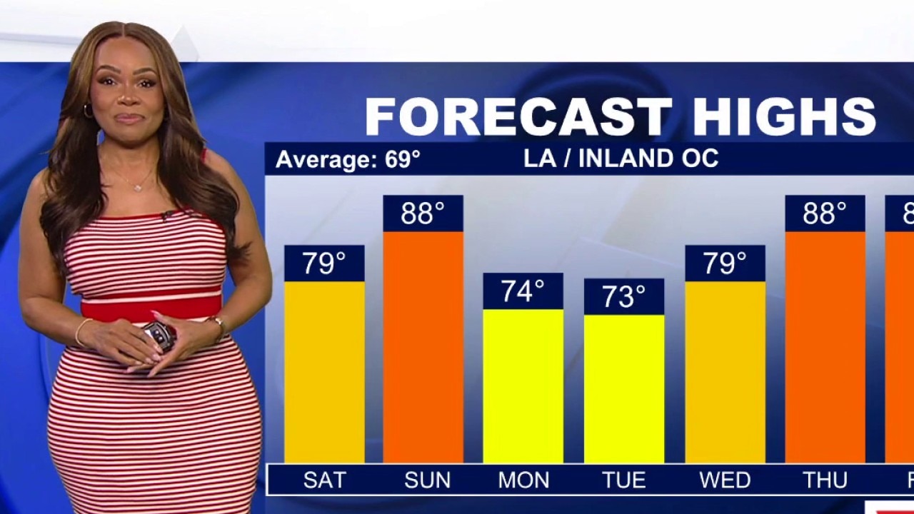
The latest forecast and air quality conditions for the greater Los Angeles area, including beaches, valleys and desert regions.
LOS ANGELES - Southern California is facing a dual threat this weekend as powerful Santa Ana winds collide with a unseasonably warm heatwave. Forecasters warn that while the strongest gusts are peaking Saturday morning, the combination of high winds and potential record-breaking temperatures will persist through Sunday afternoon.
What we know:
The National Weather Service has issued high wind warnings for the Santa Susana and San Gabriel Mountains, where gusts between 60 and 70 mph are expected.
Across the Los Angeles and Ventura county coasts and valleys, wind advisories are in effect as gusts reach up to 55 mph.
This weather pattern is driving temperatures into the upper 70s and low 80s on Saturday, with Sunday expected to see "widespread" mid-to-upper 80s—nearly 18 degrees above the seasonal average, according to the NWS.
What we don't know:
While forecasters noted that Sunday's record highs are mostly in the 90s, it's uncertain if specific local areas will break all-time calendar day records.
Additionally, the exact scale of utility disruptions is unknown, though officials have cautioned that "power outages are possible" due to damaging winds affecting lines.
Timeline:
- Friday: Initial gusts of 40–65 mph recorded; cooling begins to fade.
- Saturday morning: Peak wind strength and coverage across almost all of LA and Ventura counties.
- Saturday afternoon (3 p.m.): High wind warnings transition to wind advisories for mountain corridors.
- Sunday: Peak heat arrives with widespread 80s; winds begin a slow decline.
- Monday/Tuesday: Significant cooling trend begins, dropping temperatures by 5 to 10 degrees.
What they're saying:
"Winds will peak in strength and coverage on Saturday, when gusty northeasterly winds will occur across almost all of Los Angeles and Ventura counties," the NWS said.
Forecasters are warning of "minor to moderate heat impacts," mainly for those who work outdoors or those without air conditioning.
Additionally, officials said damaging winds could blow down trees and power lines. Drivers are advised to watch out for debris on the road and be cautious as travel will be difficult, especially for high-profile vehicles.
What you can do:
Residents are advised to secure loose outdoor furniture and remain vigilant for downed trees or power lines.
Drivers of high-profile vehicles should exercise extreme caution on the Highway 14 and I-5 corridors.
To manage the heat, officials recommend staying hydrated and limiting strenuous outdoor activity during the peak afternoon hours on Sunday.
The Source: This report is based on information from the National Weather Service.