

Southern California storm timeline: Heavy rain and flooding risk expected this week
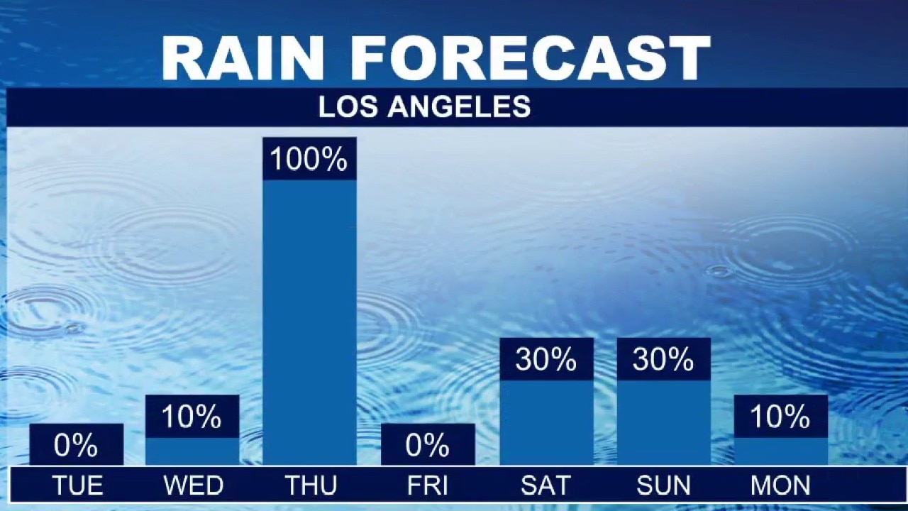
Atmospheric river hits Southern California this week
Southern California is preparing for its first atmospheric river storm of the season this week, which is expected to bring widespread rain, gusty winds, and potential flooding impacts across the region.
LOS ANGELES - A potentially powerful storm system is expected to sweep into Southern California later this week, bringing the threat of widespread heavy rain, gusty winds, and high-elevation mountain snow.
According to the National Weather Service, the system could be the first of the season to produce significant regional impacts, including localized thunderstorms, roadway flooding, and dangerous coastal hazards.
What we know:
First atmospheric river of the season
Los Angeles County is expected to see the most significant rainfall from the mid-week low-pressure system, with the most likely totals ranging from 1 to 3 inches, and 2 to 5 inches possible along the mountain slopes and foothills, according to the NWS.
Early projections show peak rainfall rates could reach 0.50 to 1 inch per hour if thunderstorms develop along the front. Forecasters warn there is at least a 15% chance of excessive rainfall that could trigger urban roadway flooding, rockslides along canyon roads, and debris flows near recent burn scars.
The storm will also bring strong winds and higher-elevation snow across the region, forecasters warn.
Los Angeles County could experience wind gusts of 30 to 50 mph, with gusts reaching 40 to 60 mph in mountain and interior foothill areas, while Orange County coastal and valley gusts could hit 25 to 30 mph.
In the Los Angeles County mountains, snow levels will start above 7,500 feet before dropping to between 6,000 and 7,500 feet behind the front, with heavy accumulations possible above 8,000 feet.
Meanwhile, large surf and dangerous rip currents are actively impacting the coast, bringing breaking waves of 7 to 9 feet in Los Angeles County and 6 to 9 feet—with sets up to 11 feet—along west-facing Orange County beaches.
Timeline:
Tuesday and much of Wednesday are expected to remain dry and cool across both counties, with below-normal high temperatures generally in the 50s and 60s.
Along the coast, a High Surf Advisory remains in effect for Los Angeles County beaches through 3 p.m. Tuesday, and for Orange County beaches through 4 a.m. Wednesday.
The storm system is projected to begin reaching Southwest California late Wednesday or Thursday, bringing moderate to heavy rain and a chance of thunderstorms through Thursday night or early Friday.
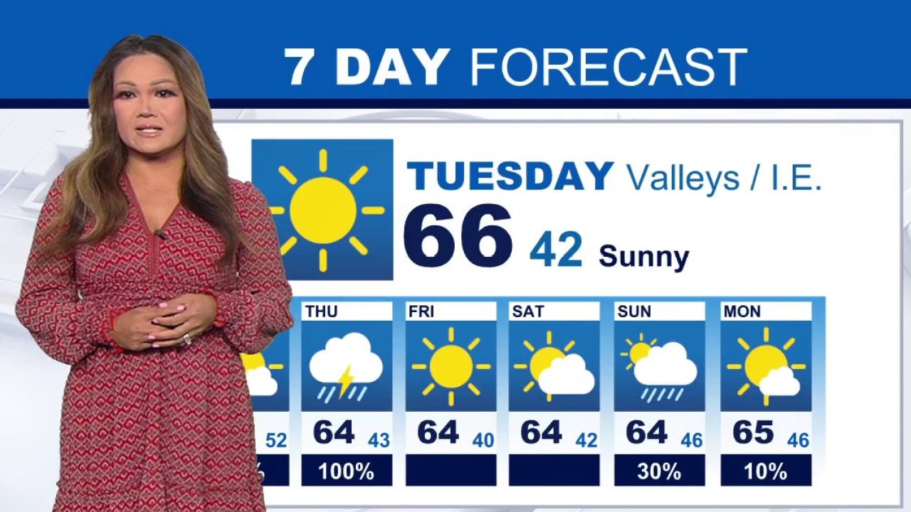
Weather Forecast for Tuesday, Nov. 17
The latest forecast and air quality conditions for the greater Los Angeles area, including beaches, valleys and desert regions.
Coastal hazards and another larger swell are expected to peak again on Thursday into Friday, though impacts are projected to be slightly lower than what the region experienced over the previous weekend.
What they're saying:
Weather officials are emphasizing the potential severity of this mid-week weather event and urging coastal residents to exercise caution.
"There is a risk for significant impacts with the low pressure system arriving mid-week, including flooding and thunderstorms," the NWS said. Regarding the overall scale of the precipitation, the agency added, "This could be the first storm of the season with truly widespread moderate to heavy rain and high elevation mountain snow."
What you can do:
Residents and visitors should closely monitor updated forecasts throughout the week and stay informed on local weather advisories, especially ahead of potentially higher tides during Thanksgiving week.
Because the ongoing high surf is expected to create dangerous swimming and surfing conditions, strong rip currents, beach erosion, and minor tidal overflow near high tide, forecasters urge beachgoers to stay completely out of the water or remain near occupied lifeguard towers.
The Source: This report is based on the National Weather Service. City News Service contributed.