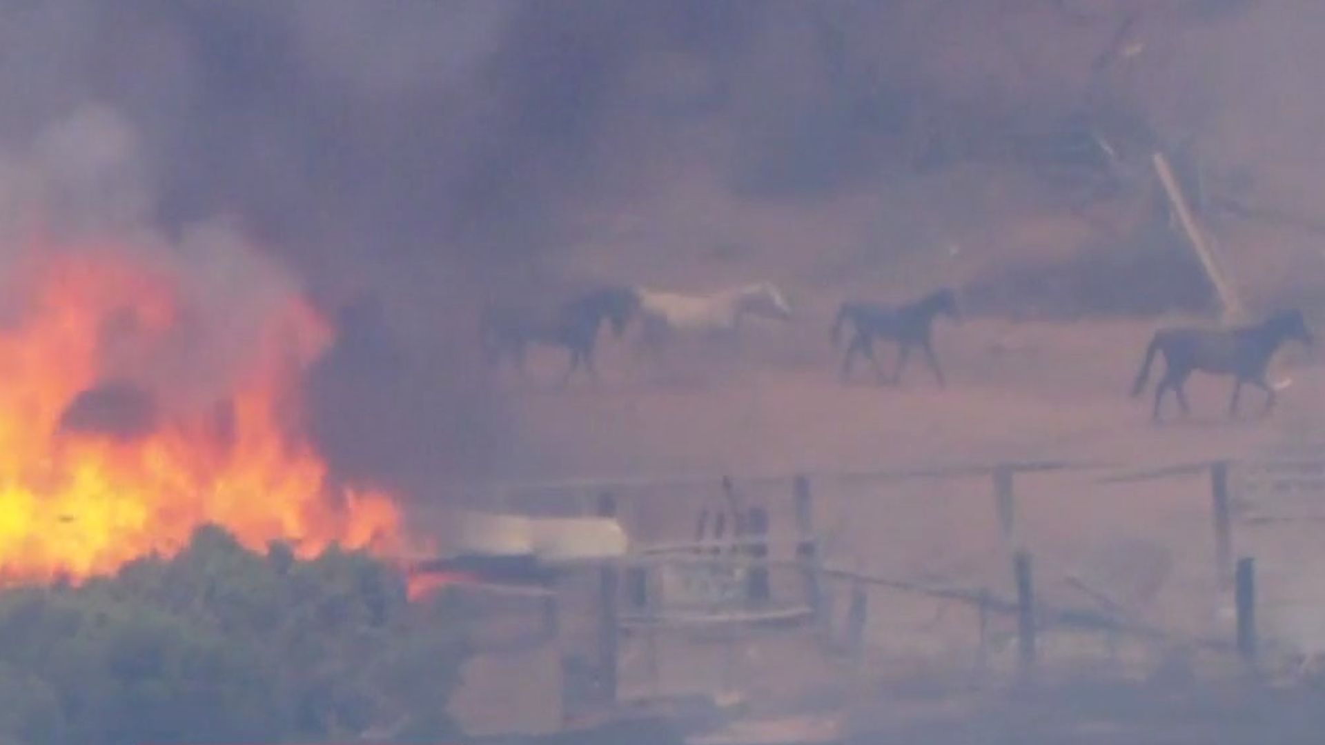
Juniper Fire burning in Riverside County forces evacuations

Several wildfires torch parts of Inland Empire
At least five separate wildfires have broken out across Riverside and San Bernardino counties over the weekend.
RIVERSIDE COUNTY, Calif. - Evacuation orders were issued as a fast-moving wildfire continues to burn in Riverside County.
What we know:
The Juniper Fire broke out Monday, June 30, just before 11:30 a.m. near Idaleona Road and Juniper Road in the City of Perris.
At last check, the fire burned 689 acres and is 30% contained.
Several horses were seen running to safety as structures were on fire in a barn.
"My neighbor sent me a picture of the fire coming over the mountain. They're the real heroes. They loaded up my horses, and my sister got everybody out. Sheriffs were walking horses out, saving my animals."
Below is a list of evacuation orders and warnings according to Cal Fire.
Evacuation Orders:
- RVC-1059
- RVC-1179
- RVC-1170
- RVC-1172
- RVC-1173
- RVC-1273 A&B
- North of Rocky HIlls
- West of Forrest Road
- East of El Nido Road
- South of Orange Avenue
Evacuation Warnings:
- RVC-1060
- North of Eucalyptus
- West of Highway 74
- East of Post Road
- South of Ellis Avenue
Evacuation map link: https://tinyurl.com/46mkvm3v
Road Closures:
Santa Rosa Mine Road is closed between Juniper Road and Post Road. Please avoid the area.
Evacuation Shelter:
A Care & Reception Center has been established at Citrus Hill High School, 18150 Wood Road, Perris, CA 92570.
Numerous wildfires break out
Big picture view:
The Juniper Fire is currently one of many fires burning in the Inland Empire.
View the full list of fires and their latest containment and acreage by clicking here.

