

4th of July forecast: Mild weather makes way for 1st significant heat wave of summer

Weather Forecast for Thursday, July 3
The latest forecast and air quality conditions for the greater Los Angeles area, including beaches, valleys and desert regions.
LOS ANGELES - Southern California is expecting mild weather through the weekend with a slight warming trend, but a significant heat wave is forecast for mid-to-late next week, according to the National Weather Service.
Inland areas will see warmer temperatures, while coastal regions remain cooler due to the marine layer.
Pleasant 4th of July weekend weather
What we know:
Mild weather is anticipated across Southern California through the upcoming weekend, with a gradual warming trend each day.
Daytime highs are projected to be in the 70s near the coast, 80s in coastal valleys, and 90s in lower mountains to the interior.
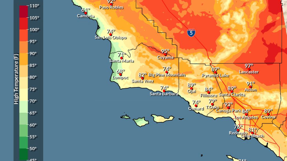
These temperatures will generally be just below normal for much of the region and within a couple of degrees of normal for the Los Angeles Basin.
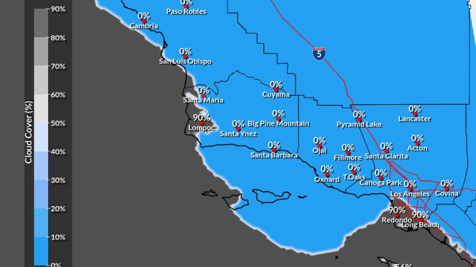
Overnight and morning marine layer clouds and fog will persist daily, extending from the beaches into the coastal valleys. There is a possibility of dense fog developing by the weekend.
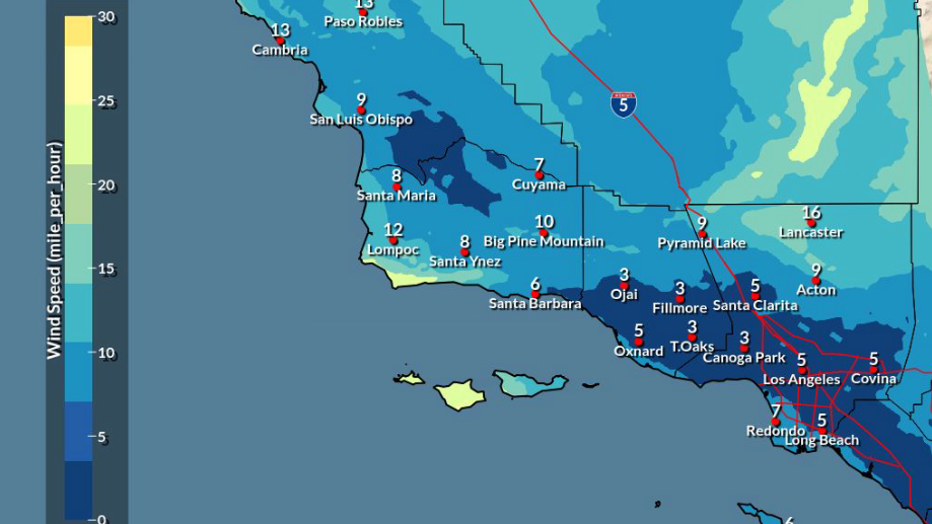
Far interior areas will experience dry conditions during the day with breezy onshore winds in the afternoons and evenings, which is typical for this time of year.
Additionally, northerly winds are expected to return to southwest Santa Barbara County starting Friday night and continuing through at least the weekend.
These winds could have gusts of 25 to 45 mph in typically windy areas, with a chance for local gusts reaching 50 mph.
The Madre Fire is currently active in southeast San Luis Obispo County, producing a substantial amount of smoke that is affecting the Cuyama Valley. Upper-level smoke from this fire is drifting south over Santa Barbara County and western parts of Ventura County.
Smokey skies may be visible from portions of Los Angeles County today, but the smoke is expected to remain elevated well above the surface.
‘Significant long-duration heat wave’
What's next:
Confidence is high for above-normal temperatures by mid-to-late next week, as most models indicate a strong ridge of high pressure building over the region.
While there is some uncertainty regarding the exact severity of this heat event, temperatures are likely to rise on Tuesday, with much of Los Angeles County reaching several degrees above normal.
The heat is then expected to intensify, peaking on Wednesday or Thursday, with the potential to last into the following weekend.
Triple-digit heat (100 degrees or greater) is favored for interior valleys and deserts, with a small chance that the warmest areas could reach or exceed 110 degrees.
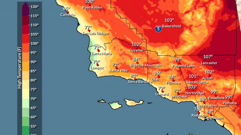
Heat advisories are likely to be issued for the warmest valleys, and there is approximately a 20% chance that extreme heat watch/warnings will become necessary for some valleys, mountains, and/or deserts.
Hazardous heat impacts are possible for all areas, with the immediate coasts being a potential exception due to the mitigating effect of marine layer clouds.
Those working outdoors, living without air conditioning, or belonging to heat-sensitive groups are advised to stay informed about the forecast and prepare for an extended period of above-normal temperatures.
Possible rain chances
What we know:
There is a chance for monsoonal moisture to reach the region next week, with about a 10 percent chance of thunderstorms primarily focused across the mountains and deserts.
These thunderstorms could begin as early as Tuesday for Los Angeles and Ventura Counties, extending across the remaining interior areas from Wednesday into late next week.
Potential hazards associated with monsoon thunderstorms include dry lightning fire starts, gusty winds, and localized heavy rain.
The Source: This article's weather forecasts are based on detailed meteorological models and expert analysis, providing confirmed information and outlining potential future developments. Insights into specific conditions, such as the Madre Fire's impact and Sundowner winds, are derived from current observational data and typical seasonal patterns from the National Weather Service.