

Southern California storm timeline: When round two of rain and 12-foot surf hits
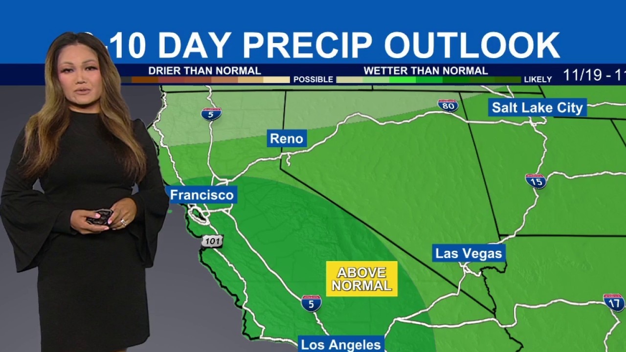
SoCal braces for back-to-back storms
Two Pacific storms are bringing widespread rain, thunder, cooler temperatures, and a High Surf Advisory with 12-foot waves to Southern California through early next week.
LOS ANGELES - Southern California’s dry stretch ended early Friday as the first of two Pacific storm systems brought overnight rain, thunder, and localized street flooding to the region.
Forecasters with the National Weather Service (NWS) expect on-and-off showers to continue through Saturday morning alongside dangerous coastal surf and sharply cooler temperatures.
What we know:
Rain chances
Graphic courtesy National Weather Service
Rain began sweeping across the Southland overnight, ending a period of unseasonably warm weather that had pushed highs into the upper 70s and near 90 degrees.
As high pressure weakens, daytime highs on Friday and Saturday will settle mostly into the 60s to low 70s with gusty winds, according to the NWS.
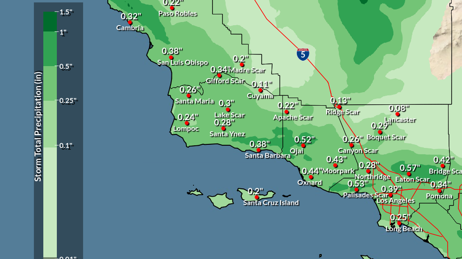
Overall chances for widespread rain sit above 90%, with most areas of Los Angeles and Orange counties expected to receive between a quarter-inch and 1 inch of total rainfall from the two systems combined, though locally higher amounts are possible on mountain slopes and in thunderstorms, officials said.
Thunder was reported overnight in several areas, including Santa Monica. Strong bursts of rain also inundated low-lying spots, including a stretch of Harry Bridges Boulevard in Wilmington, where floodwaters left several vehicles and at least one big rig stranded Friday morning along a detour route for the closed Vincent Thomas Bridge. For coastal areas of Santa Barbara, Ventura, and Los Angeles counties, the NWS noted a low chance of isolated moderate, flood advisory-level rain impacts, including flooding in low-lying areas and roads, minor mountain mudslides, and increased traffic accidents.
Coastal flooding threat
Graphic courtesy National Weather Service
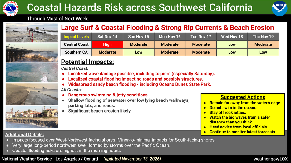
Along the coast, a High Surf Advisory is in effect for Los Angeles County beaches through 3 p.m. Tuesday, following an earlier Beach Hazards Statement for the Malibu coast and local beaches until 2 p.m. Friday. A large swell will generate breaking waves of 5 to 8 feet on Friday before peaking at 8 to 12 feet on Saturday and easing to 6 to 9 feet from Sunday through Tuesday, the NWS said.
Additionally, a Coastal Flood Advisory will be in effect from 4 a.m. to 4 p.m. Saturday, when morning high tides reaching 7.0 to 7.4 feet combine with large swells to create minor to moderate flooding in vulnerable low-lying coastal areas, including beach parking lots, bike paths, and harbor walkways.
Separately, the Los Angeles County Department of Public Health issued an ocean water-quality rain advisory through at least 8 a.m. Monday due to elevated bacteria levels from storm runoff.
What we don't know:
It is not immediately clear when the flooded stretch of Harry Bridges Boulevard in Wilmington will reopen to traffic or whether Caltrans will establish a new detour route for the Vincent Thomas Bridge closure.
What they're saying:
NWS forecasters emphasized that the overall storm pattern will bring multiple rounds of moisture to the region over the weekend.
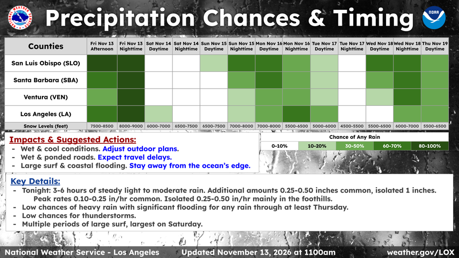
"Essentially, there will be several 'pulses' of rainfall across the area Friday through Sunday," the NWS stated, adding that "overall, most if not all areas will experience a beneficial rain."
Graphic courtesy National Weather Service
Regarding Saturday's coastal hazards, forecasters warned that "moderate flooding of sea water is likely over some vulnerable low- lying coastal areas that are normally dry, especially around the time of high tide, including over beach parking lots, bike paths, and harbor walkways."
What's next:
After Sunday’s brief dry spell, a broader "storm train" will bring two weaker, colder systems into Southern California next week.
"Pattern-wise, the 'storm train' is expected to continue with one storm impacting the area Sunday night through Tuesday then another system during the day on Wednesday/Wednesday night," the NWS said.
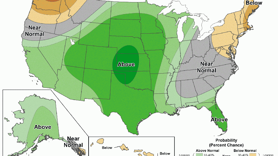
Graphic courtesy National Weather Service
Forecasters expect these midweek disturbances to deliver additional beneficial rainfall and maintain below-normal temperatures through Wednesday night or Thursday.
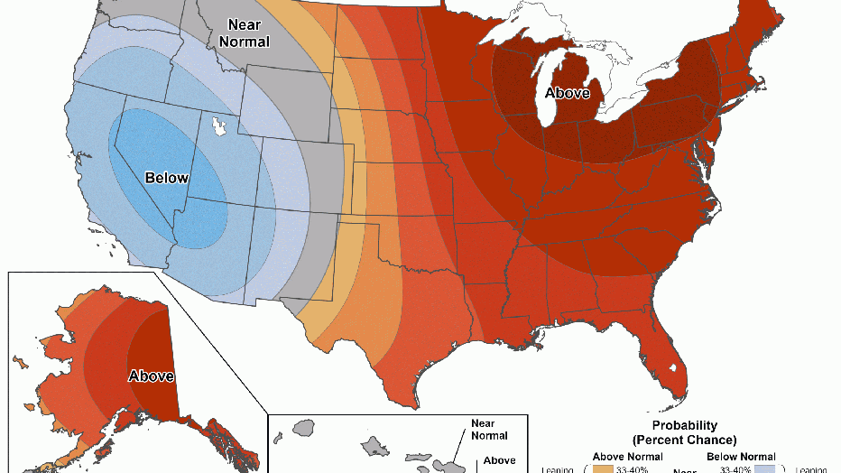
Graphic courtesy National Weather Service
What you can do:
Drivers should use caution on wet roads, follow all posted warnings, and never drive around barricades or through standing water on flooded streets.
Residents are advised to secure outdoor patio furniture or belongings exposed to gusty winds, surf, and rain, and anyone with weekend outdoor plans should adjust them for wet weather.
Along the coast, beachgoers should avoid water contact due to bacteria runoff, stay out of the surf or swim only near occupied lifeguard towers, stay completely off rock jetties, and remain alert for sneaker waves and heavy shore breaks.
The Source: This report is based on information provided by the National Weather Service. City News Service contributed.