

Southern California coastal flood advisory issued as record high tides loom

Newport Beach braces for return of King Tides
Newport Beach has declared a local emergency and activated its Emergency Operations Center ahead of King Tides scheduled for October 26–28.
LOS ANGELES - A multi-day coastal flood advisory will take effect Sunday morning across Southern California beaches as near-record high tides threaten to submerge low-lying shoreline areas.
Forecasters caution that the extreme morning tides will precede a broader weather shift expected to bring cooler temperatures and heavy rain chances by the end of the week.
What we know:
The National Weather Service (NWS) has issued a coastal flood advisory that runs from 5 a.m. Sunday to 1 p.m. Thursday for beaches across Los Angeles and Orange counties.
Forecasters project morning high tides between 7.5 and 8 feet throughout this timeframe, with peak levels between Monday and Wednesday threatening to challenge the area's all-time historical mark of 7.93 feet recorded in San Pedro on Jan. 10, 2005.
Minor flooding is anticipated along harbor walkways, oceanfront bike trails, and coastal parking areas, while a moderate risk of rip currents will persist throughout the event.

King tides, possible coastal flooding to return to SoCal coast
Crews in Long Beach are working against the clock to protect the coast ahead of king tides returning next week.
This threat follows recent weeks of elevated surf that caused substantial property damage to homes in Long Beach, Malibu, and Newport Beach.
Inland communities will simultaneously experience warmer conditions early in the week, with afternoon temperatures reaching the mid- to upper 70s before dropping late in the week.
What we don't know:
Meteorologists have not yet pinned down the exact trajectory, rain totals, or specific arrival time of the subsequent storm system expected late in the week.
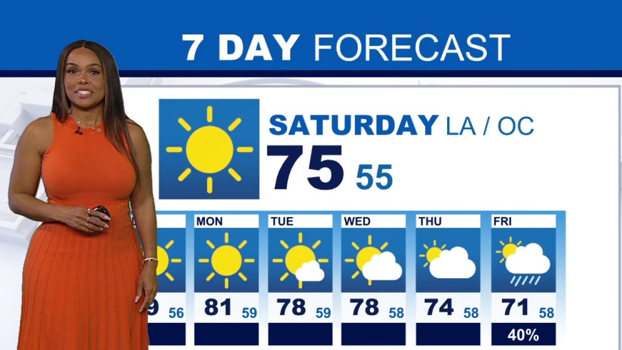
Weather Forecast for Saturday, Oct. 24
The latest forecast and air quality conditions for the greater Los Angeles area, including beaches, valleys and desert regions.
Timeline:
Sunday
The coastal flood advisory officially takes effect at 5 a.m., beginning a multi-day cycle of extreme morning high tides across Los Angeles and Orange County beaches.
Monday through Wednesday
Tides reach their highest astronomical peaks during the morning hours, presenting the highest risk of shallow inundation along low-lying harbor walkways, bike trails, and coastal parking lots.
Thursday
The coastal flood advisory officially concludes at 1 p.m. Simultaneously, onshore flow returns to the Southland and daytime temperatures drop as an area of low pressure forms along the West Coast.
Friday
Precipitation chances begin rising sharply across Southern California as the incoming low-pressure system draws closer to the coastline.
Oct. 30 – Nov. 2
Forecasters project a 90% chance of rain across the region, bringing cooler conditions and unsettled weather that is likely to impact Halloween and weekend activities.
What's next:
Looking ahead toward the end of the week, the agency noted that shifting atmospheric patterns will bring active weather back to the state.
"The pattern will start to change around Thursday, with onshore flow returning, temperatures dropping, and low pressure forming over the West Coast. This will open the storm window over California, with a growing chance of a significant storm impacting the local area as early as Friday but more so for the weekend," the NWS said.
What's next:
Regional weather conditions will transition abruptly on Thursday as the high-tide cycle wraps up, and cooler ocean air pushes inland.
Southern California residents should prepare for unsettled conditions heading into the weekend, as forecasters expect widespread disruptions to outdoor Halloween gatherings and activities due to high rain probabilities.
What you can do:
Residents and visitors in beach communities should avoid parking vehicles in low-lying oceanfront lots and plan alternative routes around coastal bike paths and harbor walkways subject to tidal flooding.
Swimmers and surfers should exercise heightened vigilance due to moderate rip currents, while local homeowners should monitor updated weather forecasts and secure outdoor Halloween decorations ahead of incoming late-week rain and gusty winds.
The Source: This report is based on information provided by the National Weather Service. City News Service contributed.