

SoCal hit by cold blast as LA breaks its longest streak of warm temps

LOS ANGELES - More cool weather, winds and scattered rain prevailed across the Southland over the weekend. On Saturday, Los Angeles saw its record streak of warm temperatures come to an end.
Cooler temperatures were expected across Southern California throughout the week with below-average temperatures in the forecast through Nov. 15.
"With a high temp of only 62 degrees today, the streak of days with a high temp of 70 or higher at Downtown Los Angeles has officially ended at 200 days. This breaks the old record from 1885 by 10 days!'' the National Weather Service's Los Angeles office tweeted late Saturday. "Pretty incredible! Time to enjoy temps in the 60s again!''
Highs on Sunday remained in the upper 50s and mid-60s in the greater Los Angeles area, with a chance of showers in the afternoon. Winds of 15 to 25 mph with gusts up to 35 mph were expected as well.
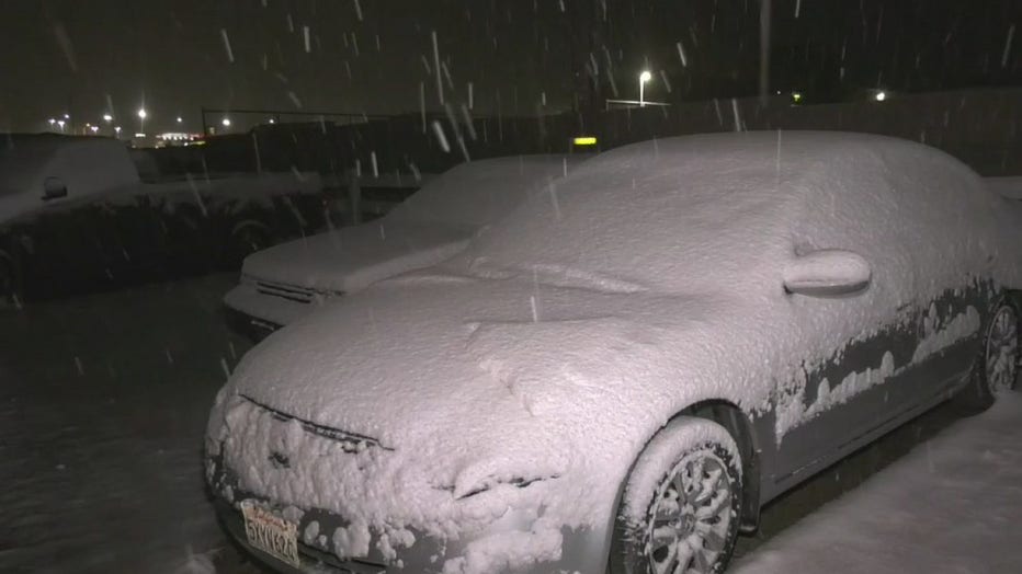
Also on Sunday, a winter weather advisory was in effect until 10 p.m. for the mountains, with snow and gusty winds. Between 2 and 3 inches of snow were expected above 5,000 feet, and 1 to 2 inches between 4,000 and 5,000 feet, including the Grapevine portion of the 5 Freeway. The forecast also called for west to northwest winds of 20 to 30 mph with gusts up to 45 mph in those areas.
Los Angeles received 11 inches of rain Saturday, ending a streak of 172 days with no measurable precipitation in downtown Los Angeles. That tied the seventh-longest such streak in recorded history.
The Los Angeles Homeless Services Authority announced Saturday that two augmented winter shelter sites would be available through 7 a.m. Monday at the following locations:
-- Echo Park Community Center, 303 Patton St. (27 beds available)
-- Hollywood Recreation Center, 1122 Cole Ave. (29 beds available)
Forecasters attributed the expected inclement weather to a low- pressure system out of the Pacific.
Along the L.A. County coastline, a high surf advisory was in effect until 4 p.m. Sunday, the NWS said. The surf will reach 3 to 6 feet in height, and a high risk of rip currents will exist, according to the NWS.
A slightly less serious beach hazard statement will remain in effect in Orange County until 2 a.m. Monday amid waves of 4-6 feet, with local sets to 7 feet. The highest surf is expected Saturday afternoon through Sunday evening.
Sunny skies were set to return Monday and a slow warming trend will begin, according to the NWS.