

Southern California storm timeline: When rain, high surf hit SoCal this week
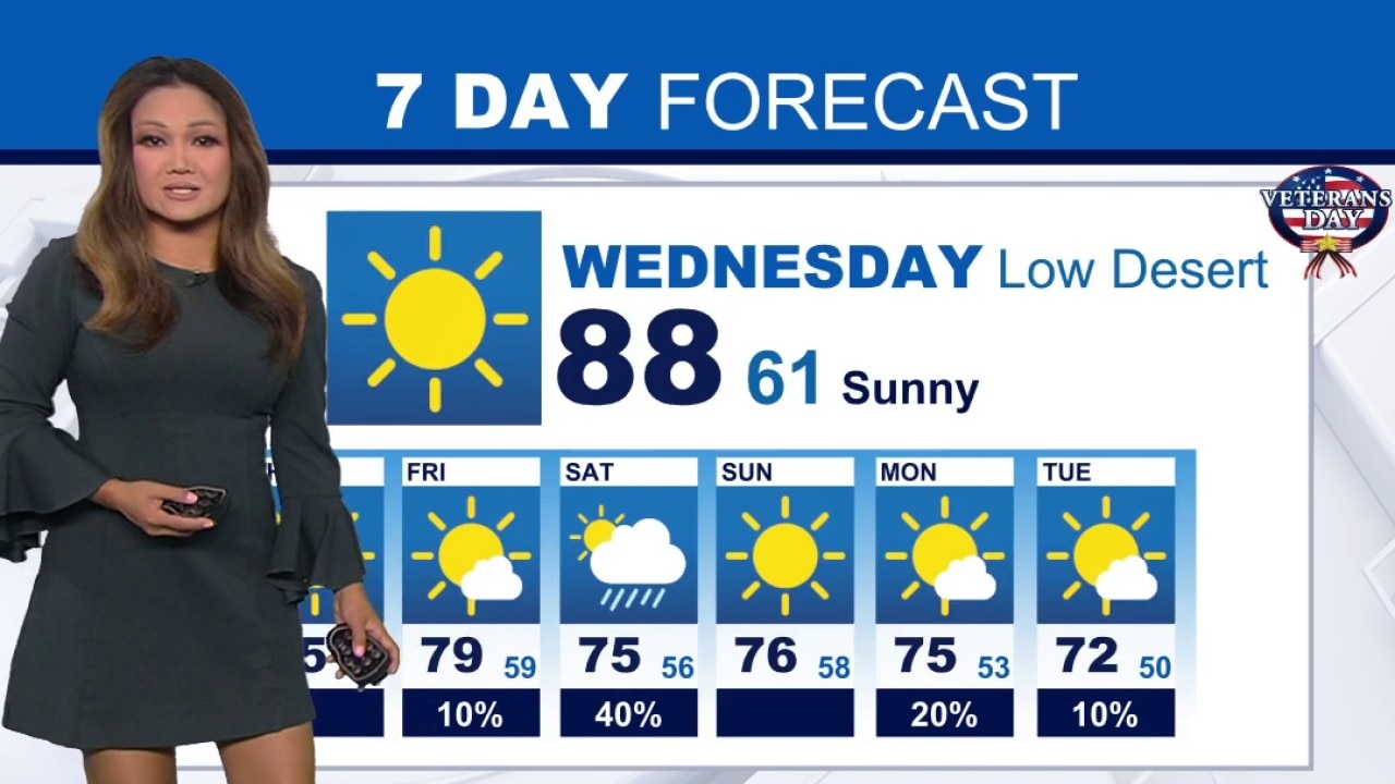
Weather Forecast for Wednesday, Nov. 11
The latest forecast and air quality conditions for the greater Los Angeles area, including beaches, valleys and desert regions.
LOS ANGELES - Unseasonable warmth across Southern California is coming to an end as consecutive low-pressure weather systems move into the region.
Forecasters warn that residents should prepare for significant temperature drops, incoming rain, and hazardous surf conditions through next week.
What we know:
Southern California is transitioning from sunny, warm conditions into an extended stretch of wet weather triggered by unsettled weather systems, according to the National Weather Service. At this time, the overall chance of widespread rain across the region is above 90%, though forecasters note there is at least a 50% chance that rain totals will stay below a half-inch through the middle of next week.
Before the arrival of this pocket of stormy weather, temperatures in Los Angeles and Orange counties will hover in the upper 70s to around 90 degrees before a sharp cooling trend takes hold on Thursday.
Coastal areas face immediate coastal flooding and high surf advisories due to morning high tides peaking between 7.0 and 7.4 feet, the NWS said.
High surf will linger into early next week, threatening beach parking lots, low-lying walkways, and bike paths with shallow flooding and beach erosion, officials added.
Timeline:
Rain chances begin as early as Thursday night or late Friday, with periods of light to moderate showers extending into Saturday morning before tapering off from west to east.
What's next:
A second, colder and faster-moving system is projected to arrive on Monday, with a third possible system possible by next Wednesday or Thursday, according to the latest forecast.
Beaches will see elevated and potentially destructive surf build over the weekend.
High pressure will continue weakening over the region, allowing cooler air to take over the recent unseasonal warmth, according to the NWS.
What you can do:
If you're driving and encounter standing water on coastal streets, follow posted warnings and never drive around barricades or through flooded roads.
Those living by the coast should exercise extreme caution near the water, staying off rock jetties and remaining vigilant against sneaker waves, heavy shore breaks, and strong rip currents.
Those with outdoor weekend plans should plan for wet weather. Residents should secure outdoor patio furniture or belongings exposed to surf and rain.
The Source: This report is based on information provided by the National Weather Service. City News Service contributed.