

Norte Fire scorches 570 acres in Orange County as firefighters reach 5% containment
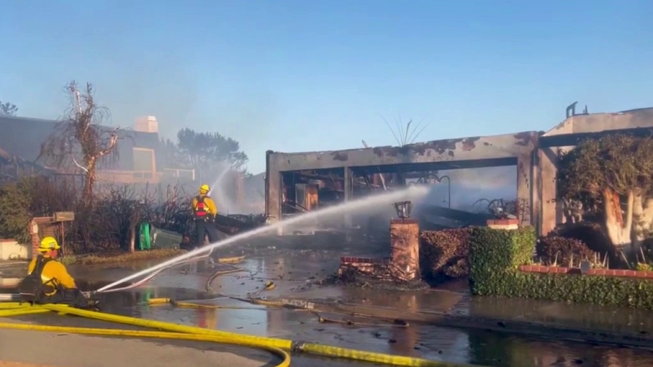
Norte Fire burns 570 acres, six homes damaged, destroyed
Firefighters will continue working overnight Friday to suppress the wind-driven Norte Fire in Orange County.
ORANGE COUNTY, Calif. - Orange County firefighters made progress against a fast-moving wildfire that erupted Friday near San Clemente and rapidly spread into neighboring San Juan Capistrano.
Driven by dry conditions and fierce Santa Ana winds, the Norte Fire expanded to 250 acres within an hour of igniting and scorched 570 acres.
Crews worked throughout the night to attack the active flames, protect structures, and establish firm perimeter lines.
What we know:
The Norte Fire broke out around 11:30 a.m. Friday in the brush near Portico Del Norte and Eminencia Del Norte in San Clemente.
Orange County Fire Authority Division Three Fire Chief Mark Backhoff confirmed that six homes were damaged or destroyed as flames tore through residential neighborhoods along Avenida Calita, Via La Mirada, and Via De Agua in San Juan Capistrano.
Two firefighters were hospitalized for heat-related injuries during the initial response, with officials noting that both are recovering well.
Fire crews maintained ground and air operations overnight, holding the blaze at 570 acres while bringing containment up to 5%.
California has secured a Fire Management Assistance Grant from the Federal Emergency Management Agency to guarantee critical federal resources remain available for suppression operations.
Evacuation orders
Mandatory evacuation orders remain in place for approximately 6,000 homes and 16,000 residents across multiple neighborhoods in San Clemente and San Juan Capistrano, stretching to areas along the San Diego freeway. The following zones are impacted:
- SCL12
- SCL13
- SJC04
- SJC05
- SJC10
Evacuation shelters
- San Juan Capistrano Community Center, 25925 Camino del Avion, San Juan Capistrano
- San Clemente Community Center 100 Calle Seville, San Clemente
What we don't know:
The official cause of the Norte Fire remains under investigation as fire crews prioritize containment and structure defense.
Emergency officials have not yet established a timeline for when mandatory evacuation orders will be lifted or when residents will be permitted to return to their homes safely.
Big picture view:
Weather conditions
While offshore Santa Ana winds are expected to weaken Saturday compared to Friday's 50 to 70 mph mountain gusts and 35 to 55 mph coastal gusts, critical fire danger will persist through much of the day due to high temperatures reaching 90 to 100 degrees and low humidity levels, according to the National Weather Service.
Red flag warnings remain in effect until 8 p.m. Saturday across large portions of Southern California, including the Santa Monica Mountains Recreation Area, San Gabriel Mountains, freeway corridors, and regional valleys, while wind advisories stay active until 2 p.m.
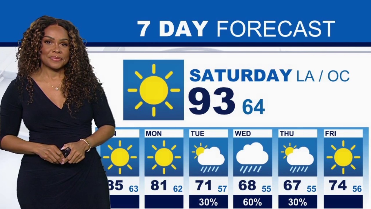
Weather Forecast for Saturday, Oct. 17
The latest forecast and air quality conditions for the greater Los Angeles area, including beaches, valleys and desert regions.
Forecasters with the NWS report that offshore winds will drop below advisory levels by Saturday night as onshore airflow returns Sunday into Monday, bringing a widespread cooling trend.
Additionally, there's an increasing chance that an incoming storm system could bring a half-inch to an inch of rain to the region by mid-week.
What's next:
Firefighting crews will continue working on the ground and from the air throughout Saturday to increase containment metrics, eliminate hot spots, and pave the way for residents to return home as soon as safety allows.
Public safety agencies advise residents in high-risk zones to review evacuation plans, ensure vehicles are fueled, avoid activities that create sparks, and prepare for potential power shutoffs.
The Source: This report is based on information provided by the Orange County Fire Authority, the Orange County Sheriff's Department, Cal Fire, and the National Weather Service. City News Service contributed.