

Hurricane Orlene weakens to Category 3 ahead of Mexico landfall
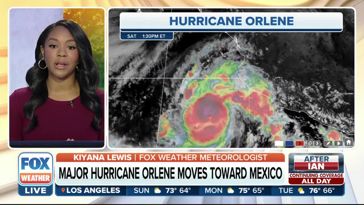
After rapidly intensifying to a Category 4 storm on Sunday morning, Hurricane Orlene has weakened a bit and is now a Category 3 storm off the western coast of Mexico, where it’s expected to make landfall Monday or Monday night.
Damaging winds, flooding rainfall and a dangerous storm surge will all be significant threats as Orlene crashes ashore in Mexico, likely as a Category 1 or 2 hurricane.
HOW TO WATCH FOX WEATHER ON TV
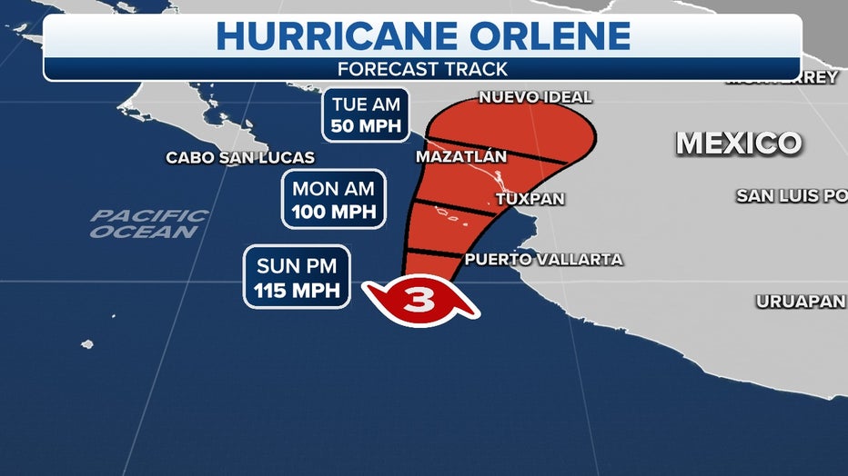
The projected path and intensity of Hurricane Orlene.(FOX Weather)
Where is Hurricane Orlene?
As of Sunday morning, Orlene was a Category 4 hurricane with maximum sustained winds of 130 mph, centered more than 100 miles southwest of Cabo Corrientes in Mexico.
Any hurricane that is rated Category 3 or higher on the Saffir-Simpson Hurricane Wind Scale is considered a "major hurricane."
TROPICAL DEPRESSION VS. TROPICAL STORM VS. HURRICANE: WHAT'S THE DIFFERENCE?
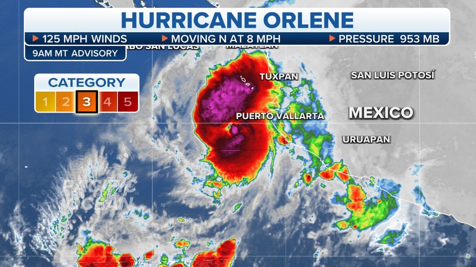
Tropical Hurricane Orlene. (FOX Weather)
Where are watches and warnings in effect?
A Hurricane Warning is in effect for Las Islas Marias – an archipelago of four islands some 60 miles off the coast of Mexico's Nayarit state – and along the western coast of mainland Mexico from San Blas to Mazatlan.
Hurricane-force winds (74-plus mph) are expected in Las Islas Marias on Sunday night, with tropical-storm-force winds (39-plus mph) beginning later Sunday. Hurricane-force winds are expected in the Hurricane Warning area along the western coast of mainland Mexico late Monday, with tropical-storm-force winds beginning early Monday.
A Tropical Storm Warning is in effect along the western coast of mainland Mexico from Playa Perula to San Blas. Tropical-storm-force winds are expected in this area on Sunday morning.
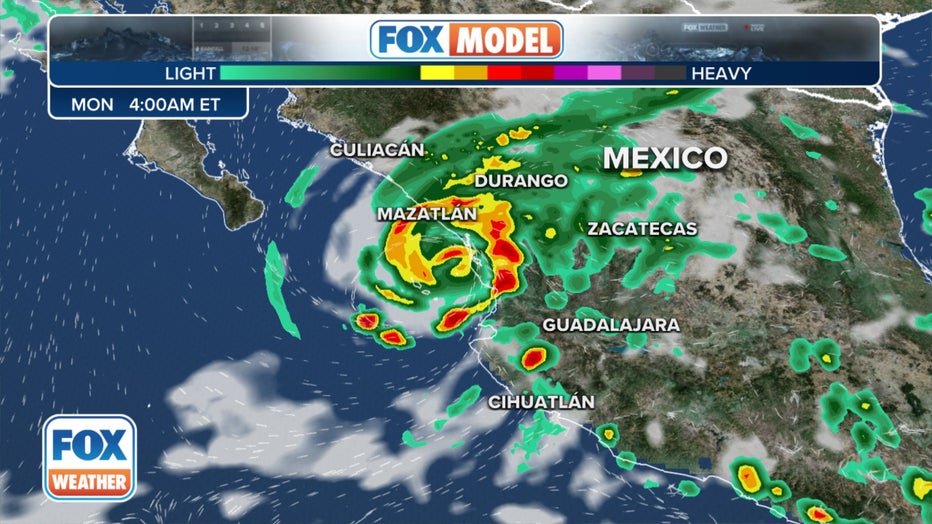
Forecast position of Hurricane Orlene from the exclusive FOX Model. (FOX Weather)
A Hurricane Watch is in effect along the western coast of mainland Mexico from Playa Perula to San Blas and from Mazatlan to Bahia Tempehuaya. Hurricane-force winds are possible in this area by Sunday night or early Monday.
A Tropical Storm Watch is in effect along the western coast of mainland Mexico from Manzanillo to Playa Perula. Tropical-storm-force winds are possible in this area on Sunday.
HURRICANE, TROPICAL STORM WATCH VS. WARNING: WHY IT'S IMPORTANT TO KNOW THE DIFFERENCE
What is the forecast and expected impacts of Hurricane Orlene?
Hurricane Orlene was moving northward on Sunday morning, and a turn toward the north-northeast is expected later Sunday. Some additional strengthening is possible through Sunday morning, followed by weakening beginning later Sunday and continuing through landfall.
According to the FOX Forecast Center, the center of Hurricane Orlene should pass near or over Las Islas Marias Sunday night or Monday morning, then reach the western coast of mainland Mexico within the Hurricane Warning area Monday night or in the pre-dawn hours of Tuesday morning.
"We'll be anticipating that landfall sometime early Tuesday morning, really between the zone of Tuxpan as well as Mazatlan, so again, this is a very popular destination for tourists, and also, it's really known for its rainforests," FOX Weather meteorologist Kendall Smith said.
In addition to high winds, Hurricane Orlene is expected to dump 3 to 5 inches of rain along its path through Tuesday. Localized rainfall amounts as high as 10 inches are possible in some areas.
These rainfall amounts will likely result in flash flooding, as well as possible landslides in areas of rugged terrain.
A dangerous storm surge is also expected to cause coastal flooding along the western coast of mainland Mexico, particularly in regions of strong onshore winds.